3D Laser Scanning
3D laser scanning is a technology that allows for the measure and capture of the physical geometry and dimensions of real-world objects or spaces. It works by emitting laser beams in a specific pattern towards the object or space, which then reflects the light back to the scanner. By measuring the time it takes for the light to return, the scanner can calculate the distance between itself and the object, generating a point cloud of millions of data points that represent the object's surface. In this article, we will dive deeper into the technical details of 3D laser scanning, and explain why it serves as the base for creating intelligent digital twins.
The process of 3D laser scanning starts with the scanner emitting a laser beam towards the object or space. The scanner then measures the time it takes for the laser to bounce back to it, using a photodetector to receive the reflected light. The scanner repeats this process multiple times from different angles and positions, generating millions of data points that create a point cloud of the room or object's surface.
The resulting point cloud contains information about the object's shape, size, and texture. However, it is important to note that the point cloud alone does not represent the object's physical properties, such as its material and color. These additional details are added to the point cloud using our specialized scanner, including texture mapping and colorization tools.
Digital twins are virtual replicas of real-world objects or spaces that are used for simulation and analysis. To create an accurate and intelligent digital twin, it is necessary to capture the physical geometry and dimensions of the object or space. 3D laser scanning provides an efficient and accurate method for doing so, as it can capture the object's shape and size with high precision.
The point cloud generated by 3D laser scanning is used to create a 3D model of the object or space, which serves as the base for the digital twin. The 3D model can be enhanced with additional data, such as sensor readings and environmental factors, to create an intelligent digital twin that simulates real-world conditions accurately.
The applications of digital twins are diverse, from building and infrastructure design to predictive maintenance and operations optimization. By creating a digital twin, engineers and designers can simulate different scenarios and test the object's behavior under various conditions, making informed decisions and reducing the risk of errors and failures.

Photogrammetry
Photogrammetry is a widely used technology in creating accurate 3D models of physical objects and environments. It uses photographs taken from multiple angles to create a 3D model of the object or environment being scanned. In this article, we will explore how photogrammetry works and why it improves 3D laser scanning for creating digital twins.
Photogrammetry works by using photographs taken from multiple angles of an object or environment. The photographs are analyzed by specialized software that identifies common points in each image. These common points are used to triangulate the position of the object in 3D space.
Our software engineers then creates a 3D point cloud from the triangulated positions, which is used to create a 3D model of the object or environment. The photographs used in photogrammetry can be taken from a variety of sources, including drones, helicopters, and cameras mounted on tripods.
Photogrammetry also allows for the creation of texture maps, which are overlaid on the 3D model to provide a realistic representation of the object or environment being scanned.
While 3D laser scanning is a powerful technology for creating digital twins, it has some limitations. One of the limitations is that it can only capture the geometry of an object or environment. It does not capture color or texture information, which can be important in creating a realistic virtual representation.
Photogrammetry addresses this limitation by capturing both the geometry and texture of the object or environment being scanned. The photographs used in photogrammetry capture the color and texture information, which is then overlaid on the 3D model created from the laser scan.
By combining the geometry information from 3D laser scanning and the texture information from photogrammetry, a more realistic and accurate digital twin can be created. This improves the accuracy of simulations and predictions made using the digital twin.
Furthermore, photogrammetry can also be used to capture areas that are difficult or impossible to scan using a laser scanner. For example, areas with complex shapes, such as vegetation, can be scanned using photogrammetry.

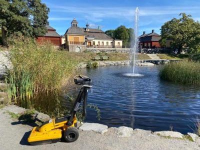
Ground Radar
Ground radar, also known as ground-penetrating radar (GPR), is a non-destructive technology that uses electromagnetic waves to image the subsurface of the ground. It is a valuable tool for creating digital twins of underground structures and landscapes.
Ground radar works by emitting short bursts of electromagnetic waves into the ground and measuring the time it takes for the waves to bounce back to the surface. The waves bounce back when they encounter a change in the electrical properties of the subsurface material, such as a rock or void. These changes in electrical properties are then recorded by the radar and used to create an image of the subsurface.
The electromagnetic waves used in ground radar technology range from high-frequency radio waves to low-frequency microwaves. The choice of frequency depends on the depth and resolution required for the imaging task. Higher frequencies provide better resolution but are limited to shallower depths, while lower frequencies provide poorer resolution but can penetrate deeper into the ground.
3D laser scanning and photogrammetry are effective technologies for creating digital twins of above-ground structures, but naturally have limitations when it comes to imaging the subsurface. Ground radar technology addresses these limitations by allowing for the creation of accurate 3D models of underground structures and landscapes.
Ground radar technology provides information on the subsurface materials and structures, including soil, rock, voids, and buried objects. This informationis used to create accurate 3D models of the subsurface, which we combine with above-ground 3D models created using 3D laser scanning. The result is a complete and accurate digital twin of a structure or landscape, both above and below ground.
Ground radar technology also allows for the detection of subsurface objects, such as buried utilities and archaeological features. These objects can be difficult or impossible to detect using 3D laser scanning alone, making ground radar technology a valuable addition to the digital twin creation process.